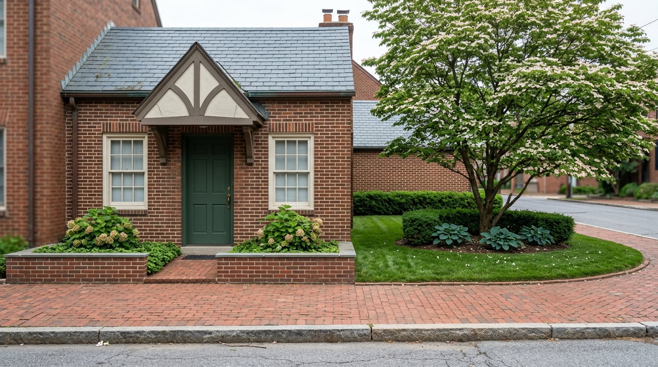
On Halloween night, Lower Q Street Circle fills with string lights, folding tables, and enough parents holding flashlights to make the boxwood hedges glow. The event is called Foxhall Fright, and it pulls in trick-or-treaters from well outside the neighborhood's own boundary. There is no marquee, no ticket link, no storefront to announce it. The party happens on a traffic island because a traffic island is the closest thing this neighborhood has to a town square.
That fact says more about Foxhall than any list of Tudor architecture details ever could. This is a roughly 310-home historic district with one commercial building and a single sandwich counter inside its own lines, and yet it runs one of the more active neighborhood calendars in Northwest DC. It manages that by treating everything just outside its property line as if it belongs to it anyway.
A Neighborhood With One Sandwich Shop and No Main Street
Foxhall Village has one commercial building and one place to buy lunch: Jetties, a sandwich shop that doubles as the neighborhood's only retail address. There is no Metro station inside the boundary. The D6 bus runs along Reservoir Road and Foxhall Road, but most residents drive, and the nearest actual shopping is Foxhall Square, a medical and retail complex on New Mexico Avenue that sits a five-minute drive north, outside the neighborhood entirely.
A place with that little built-in infrastructure usually goes one of two ways. Either it stays quiet and disconnected, or its residents start borrowing what's nearby and calling it their own. Foxhall picked the second option, and it shows up in almost every civic detail once you start looking for it.
Three Circles That Were Designed for Cars, Not Cookouts
The clearest example sits in plain sight. When the developer Boss & Phelps platted Foxhall Village in 1925, the plan included three traffic circles: one where Greenwich Parkway meets Surrey Lane, and two more spaced along Q Street NW. They were built to slow cars and organize intersections, nothing more. Nobody drew them up as gathering space.
A century of cherry trees and mulberries later, that's exactly what they've become. The shade from those trees now covers impromptu picnics and pickup soccer games most weekends, and Lower Q Street Circle is where Foxhall Fright happens every fall. A neighborhood with no park inside its own boundary turned its road infrastructure into one instead.
The Rec Center That Isn't Technically Foxhall's
The same pattern shows up a few blocks over, at the Hardy Recreation Center on Q Street NW. Hardy sits technically inside Georgetown's boundary, not Foxhall's, but you would not know that from how residents talk about it. It's described locally as more than a rec center: this is where Foxhall actually happens.
"More than a rec center, this is where Foxhall actually happens."
The lime-green playground slides are a known neighborhood landmark. A splash pad runs from Memorial Day through Labor Day, and the grounds include tennis courts, a basketball court, table tennis, and a dog park. It's also where the Foxhall Community Citizens Association, known as the FCCA, holds its general meetings, typically four times a year, spaced across January or February, March or April, September, and November. This spring, on April 15, the guest speaker was Ward 3 Councilmember Matt Frumin, who fielded questions from residents in the same room booked for splash-pad sign-ups and birthday parties the rest of the year.
The FCCA itself has been doing this longer than the traffic circles have had mature trees. It started in 1928 as the Foxhall Village Citizens Association, serving only the original Tudor rowhouse blocks. By the 1940s it had renamed itself the Foxhall Community Citizens Association to reflect neighborhoods that had grown up around the original village, a rebrand that turned out to be the first sign of a pattern that never really stopped.
A Civic Association Bigger Than the Neighborhood It's Named For
Here is the detail that makes the borrowed-geography idea more than a metaphor. The FCCA's official service area is not limited to the roughly 310 homes inside the Foxhall Village historic district. Its bylaws define a much larger rectangle bounded by Glover-Archbold Park on the east and north, ending at Whitehaven Parkway, then south and west from Whitehaven Parkway to Canal Road before returning east to Glover-Archbold Park. Inside that rectangle, the association also represents residents of:
- East Palisades
- Canal View
- Colony Hill
- Senate Heights
- Dumbarton
- Charleston Terrace
- Indian Rock Terrace
- Georgetown Reservoir
That's seven other named communities carried under one letterhead built for Foxhall Village. It isn't scope creep. It's the same logic as the traffic circles and the rec center, applied to governance instead of geography: if the amenity you need sits just past your own edge, you fold that edge into your definition of home.
The results have been concrete. The FCCA negotiated with Georgetown University to withdraw a proposed loop road that would have cut through land adjacent to Glover-Archbold Park, and it partnered with the DC Department of Parks and Recreation to restore Hardy Field, the same field with the lime-green slides. It also keeps an eye on how nearby university growth affects parking and the conversion of family homes into student rentals, an issue that matters more in a neighborhood with no spare inventory to absorb the pressure.
Where the Sidewalks End: Glover-Archbold to Battery Kemble
The outdoor life follows the same rule. Glover-Archbold Trail runs along Foxhall's eastern edge for about 3.5 miles, unpaved and wooded enough to feel remote despite sitting minutes from Georgetown. At its southern end it connects into the C&O Canal Towpath, accessible from MacArthur Boulevard, a path that technically continues 184.5 miles to Cumberland, Maryland, though most Foxhall residents only need the first mile or two for a flat morning walk.
Head north instead of south and you reach Battery Kemble Park, a 57-acre park built around an 1861 Civil War fortification that once held two 100-pounder Parrott rifles aimed at Chain Bridge and the Virginia shore. The earthworks are still visible under the underbrush, and the same steep hills that made the position defensible now make it Foxhall's unofficial best sledding hill after a snowfall. None of this acreage sits inside the historic district. All of it functions as if it does.
A short walk in a different direction lands you at Mount Zion Cemetery in nearby Kent, a privately owned burial ground established in 1868 by a Black mutual aid society to provide dignified burials during and after the Civil War. It's remarkably well preserved and opens to the public one day a year, on Memorial Day, a small but real reminder that this stretch of Northwest DC carries more layered history than its Tudor facades let on.
The Village Without a Village Green Doesn't Need One
Put it together and Foxhall's identity looks less like a neighborhood with clear edges and more like a set of borrowed rooms it has furnished as its own. The traffic circles were laid out for cars in 1925 and became the only green space residents have. The rec center that hosts the FCCA's meetings and the neighborhood's kids sits under Georgetown's address, not Foxhall's. The trail system, the sledding hill, and the historic cemetery all sit just past the boundary line on a map, yet none of them read as someone else's territory to the people who actually live here.
Even the architectural protection that keeps those brick Tudor facades intact runs through a citywide body rather than a private association. Foxhall Village earned National Register of Historic Places status in 2007, which means the DC Historic Preservation Review Board, not a homeowners' association, approves most exterior changes. It's one more example of the neighborhood relying on a larger structure to protect something small.
None of this is a workaround or a sign of something missing. It's a neighborhood that figured out, a century ago, that you don't need your own park if you're willing to claim the one next door. If you're the kind of person who already treats Hardy's dog park like an extension of your own yard, you already understand the logic. The rest of Northwest DC is only starting to notice.
If you're curious what else about Foxhall doesn't show up on a map, or you're weighing a move into one of the DMV's more tightly held historic districts, The Alliance Group knows this pocket of the city block by block. Book a Private Consultation to talk through what living inside those borrowed boundaries actually looks like day to day.